2/15/2015
Landmark information
- Location:
NW corner of 28th and L Sts, Sacramento - Plaque:
Official State Plaque - Site:
Nothing Remains - Date First Visited:
2/29/1996 - Date Most Recently Visited:
2/15/2015 - GPS Coordinates:
N 38 34.313, W 121 28.226
About this landmark
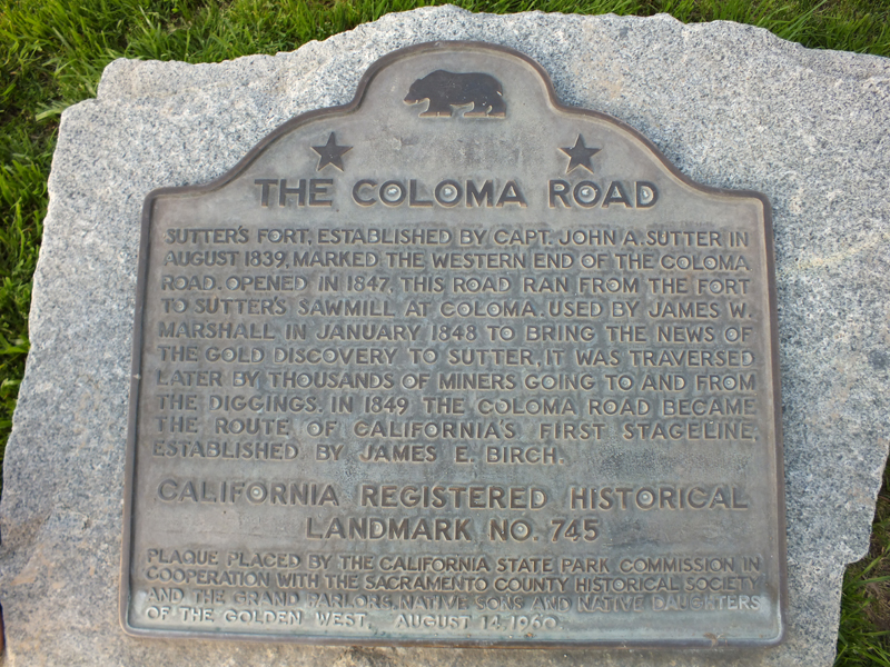
Plaque text:
The Coloma Road
Sutter's Fort, established by Capt. John A. Sutter in August 1839, marked the western end of the Coloma Road. Opened in 1847, this road ran from the fort to Sutter's sawmill at Coloma. Used by James W. Marshall in January 1848 to bring the news of the gold discovery to Sutter. It was traversed later by thousands of miners going to and from the diggings. In 1849 the Coloma Road became the route of California's first stageline, established by James E. Birch.