5/6/2009
Landmark information
- Location:
Hwy 178 (PM 88.0), 0.2 mi W of junction with Hwy 14, near Indian Wells - Plaque:
Official State Plaque - Site:
Existing - Date First Visited:
5/22/1997 - Date Most Recently Visited:
5/6/2009 - GPS Coordinates:
N 35 36.123, W 117 54.432
About this landmark
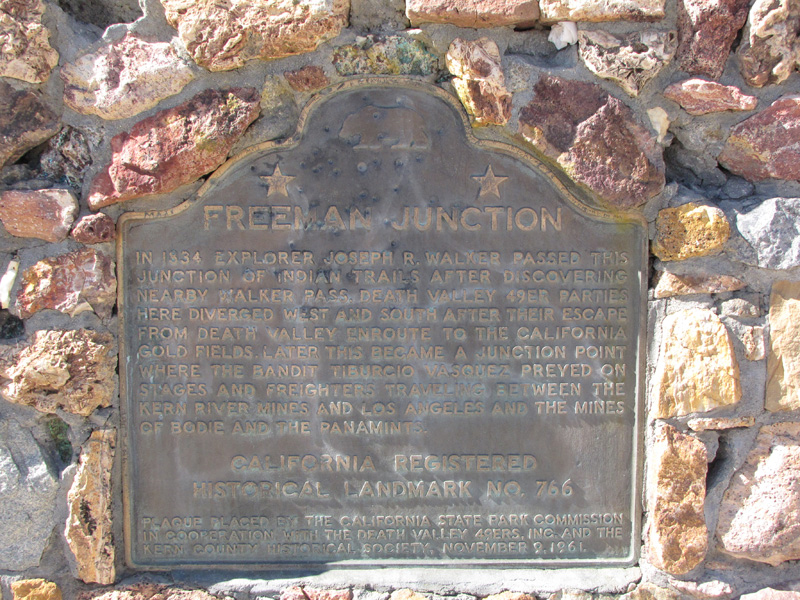
Plaque text:
Freeman junction
In 1834 explorer Joseph R. Walker passed this junction of indian trails after discovering nearby Walker Pass. Death Valley 49er parties here diverged west and south after their escape from Death Valley enroute to the California gold fields. Later this became a junction point where the bandit Tiburcio Vasquez preyed on stages and freighters traveling between the Kern River mines and Los Angeles and the mines of Bodie and the Panamints.